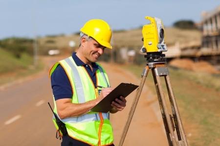
For those interested in a career in land surveying, exploring the field of geomatics could be beneficial. What is geomatics and what does it have to do with land surveying? The answer to that might surprise you!
Geomatics is a link between land surveying and cartography which integrates the two using modern technology such as remote sensing, global positioning systems and geographic information systems.
By familiarizing yourself with the tools above, you will gain insight into how land surveyors operate and what an important role geomatics play in that.
Remote Sensing
The short version of remote sensing is that it is a tool which detects and monitors the physical characteristics of an area. Remote sensing utilizes cameras, typically on satellites or airplanes, to take images of large areas on the earth’s surface. This helps rangers to scan the area more clearly than what they may see on the ground which allows them to map forest fires. Weathermen use remote sensing to track clouds to predict weather and prepare the public of incoming storms. Land surveyors often use remote sending to watch the growth of cities and farmland over the course of many years.
Global Positioning System
When you think of global positioning system, otherwise referred to as GPS, many things probably come to mind. Many people use GPS for entertainment now, for things such as geocaching. In recent years, GPS has contributed to the major innovations of Uber and Lyft facilitating telematics systems to improve driver productivity and safety.
In terms of construction, this vital tool assists with locating equipment, measuring, and improving asset allocations. GPS is also used to map and predict weather which helps to prepare emergency responders that fight natural disasters. GPS is a key tool when collaborating and problem solving across many fields.
Geographic Information System
Geographic information system is a fancy way of saying the science of our world is collected accurately, analyzed precisely, and inferred with visualizations that explore patterns, relationships and situations. The use of maps and 3D scenes are especially helpful tools when reviewing data that will later be applied practically and assist in complex problem solving. The imagery, boundaries, landscapes, and demographic data layers all contribute to the field of geomatics and, more specifically, land surveying.
With a better understanding of the tools relied on for land surveying, among many other industries, you can be more aware of how a land surveyor conducts projects.
Based in Shaftsbury, Vermont, BLAZE Design Inc. is a comprehensive surveying company dedicated to providing quality and cost-effective land use planning and surveying services in Vermont and New York.
