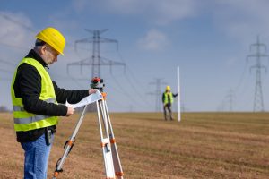
Land use planning and zoning are essential components of urban development and ensure the efficient and sustainable use of land. At the heart of effective land use planning and zoning lies the expertise of land surveyors. These professionals play a critical role in assessing, mapping, and providing accurate information about the land, which serves as the foundation for informed decision-making and responsible development.
Establishing Property Boundaries
One of the primary responsibilities of land surveyors in land use planning is to accurately determine and establish property boundaries. By conducting boundary surveys, surveyors can precisely define the extent of individual properties, ensuring that each owner’s rights and limitations are respected. These boundaries serve as the basis for land use regulations, zoning restrictions, and the allocation of land for different purposes.
Identifying Topographic Features
Land surveying provides detailed information about the topographic features of the land, including elevation, slope, natural drainage patterns, and geological characteristics. This data is crucial for understanding the physical constraints and opportunities presented by the land. It helps planners identify suitable areas for development, conservation zones, and infrastructure placement, while considering factors like flood risk, soil stability, and environmental impact.
Assessing Land Suitability
Land surveyors assess the suitability of land for various uses based on factors such as soil composition, land gradient, and accessibility. Their expertise allows them to evaluate the feasibility of different development projects, such as residential, commercial, industrial, or recreational areas. Surveyors provide vital information that helps planners make informed decisions about land use allocation and zoning regulations, ensuring the efficient and sustainable utilization of available resources.
Supporting Infrastructure Planning
Efficient infrastructure planning is crucial for the smooth functioning of communities. Land surveyors play a key role in this process by providing precise data on existing infrastructure networks, including roads, utilities, and drainage systems. By mapping these elements accurately, surveyors enable planners to identify potential conflicts, plan for infrastructure expansion, and ensure proper integration with existing systems. This information also aids in optimizing transportation routes, reducing costs, and improving overall community connectivity.
Collaborating with Stakeholders
Land surveyors act as intermediaries between various stakeholders involved in land use planning and zoning. They engage with landowners, developers, government agencies, and community representatives to gather essential information and understand diverse perspectives. Surveyors facilitate communication and help bridge the gap between technical data and stakeholders’ needs, fostering collaboration and consensus-building for successful land use planning initiatives.
Monitoring and Compliance
Land surveyors also play a role in monitoring and enforcing compliance with land use regulations and zoning ordinances. By conducting surveys at different stages of a project, surveyors ensure that the development adheres to the approved plans and meets the required standards. This helps maintain the integrity of zoning designations, protect public safety, and safeguard the environment.
Contact BLAZE Design Inc. at 802-442-2892 today or visit us online for more information!
