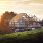
Category: Evolution of Land Surveying

Land Surveying Projects in the Winter Is an American Tradition

The New Year is not just an exciting time for people hoping to change themselves with their resolutions; it is also an exciting time for businesses nationwide. A New Year means a new start, an opportunity to start fresh and unencumbered. There is only the future ahead of you and the worthwhile projects that will… Read more »

The Four Norths

In order to obtain accurate measurements across a wide variety of topographic features, surveyors look to not just one, but four norths, each of which denotes a different direction and point of reference. Many people outside of the profession don’t realize just how flexible the term “north” really is. Rather than referring to just one… Read more »

New Technology is Changing the Face of Survey Work

Not long ago, survey equipment was largely limited to tape measures, levels, and stakes. Surveyors hit the field in multi-man teams, working in tandem to delineate property lines and identify topographic features. Survey work entailed a slow, albeit effective process of measuring and marking the land for future projects.   Today, survey equipment is virtually… Read more »

The Evolution of Land Surveying

  The profession of land surveying is in fact one of the oldest in the world, dating back to 2700 BC in Egypt during the construction of the Great Pyramid at Giza. Since then, the practice has been viewed with the utmost significance as it determines boundaries and ownership of land. You see, the importance… Read more »