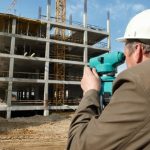
Most people commonly associate GPS with driving directions. But the truth is that GPS is being used in many different walks of life these days and helping to get jobs done. For example, the surveying industry has started to rely on GPS more and more when it comes to doing things like establishing property lines… Read more »
Flood Certificates: What Are They and Why Do You Need One?
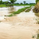
Is your property located in a flood zone? This is something that you should know when building a new home or commercial structure, you may face certain flood risks as a result of your building’s location. You may also be required to obtain special flood insurance for your property if you are located within a… Read more »
Surveying in Snow: Getting Properties Surveyed During Winter
Surveying a property in the middle of the winter when there is snow on the ground is certainly not ideal. Snow will often obscure land markers and make it difficult for surveyors to see the property they are surveying. But a land surveyor should be prepared to work in any kind of weather to get… Read more »
It’s About Time: A Change to the Second Could Improve Surveys
As the saying goes, time is of the essence. And if you didn’t think time could be any more accurate than the atomic clocks that most digital devices rely on daily, think again. Have you ever thought about how long a second really is? You probably haven’t because it’s here and gone in the blink… Read more »
Buying New Land? Have a Land Use Planning Survey Performed
There’s so much that goes into buying new land to build a home or commercial structure on. We wish it were as simple as buying the land, signing on the dotted lines, and starting the building process, but unfortunately it’s far from it. With so many factors to consider, such as drainage, stability concerns, traffic… Read more »
When You Need a Topographic Survey
A topographic survey offers an ideal way to identify and map the surface features of the terrain in a given area. This very accurate system accounts for all of the existing objects in the area, from major features like trees, buildings and streets to every smaller item including manholes, retaining walls and utility poles. These… Read more »
Drones: Possibly a New Tool for Land Surveying
The surveying industry has forever been changed by the newest trend on the market – drones. For years, it has been common for land surveyors to use laser scanners to measure properties of all sizes and collect the data needed for assessment, construction and permitting. The invention of drones with laser scanners, however, has made… Read more »
Land Surveying Projects in the Winter Is an American Tradition
The New Year is not just an exciting time for people hoping to change themselves with their resolutions; it is also an exciting time for businesses nationwide. A New Year means a new start, an opportunity to start fresh and unencumbered. There is only the future ahead of you and the worthwhile projects that will… Read more »
Becoming a Land Surveyor
In my last post, I discussed the ways that we should be thankful for land surveying. For this post, I would like to focus on some of the pluses of being a land surveyor, how it can bring much joy to your life if you decide to pursue it as a career. Joy. That’s an… Read more »
This Thanksgiving, Be Thankful for Land Surveyors
This Thanksgiving, are you thankful for America? We recently celebrated Veterans Day; of course, you’re thankful for America, but did you know that America wouldn’t be America without the skills and dedication of land surveyors throughout its history? It’s important to educate the public on the importance of the land surveying industry – why… Read more »